Evaluating Shoreline Stability
In this video, I'm going to show you one of my favorite tools to help a buyer determine if they want to engage with a geotech consultant and figure out the stability of a shoreline.
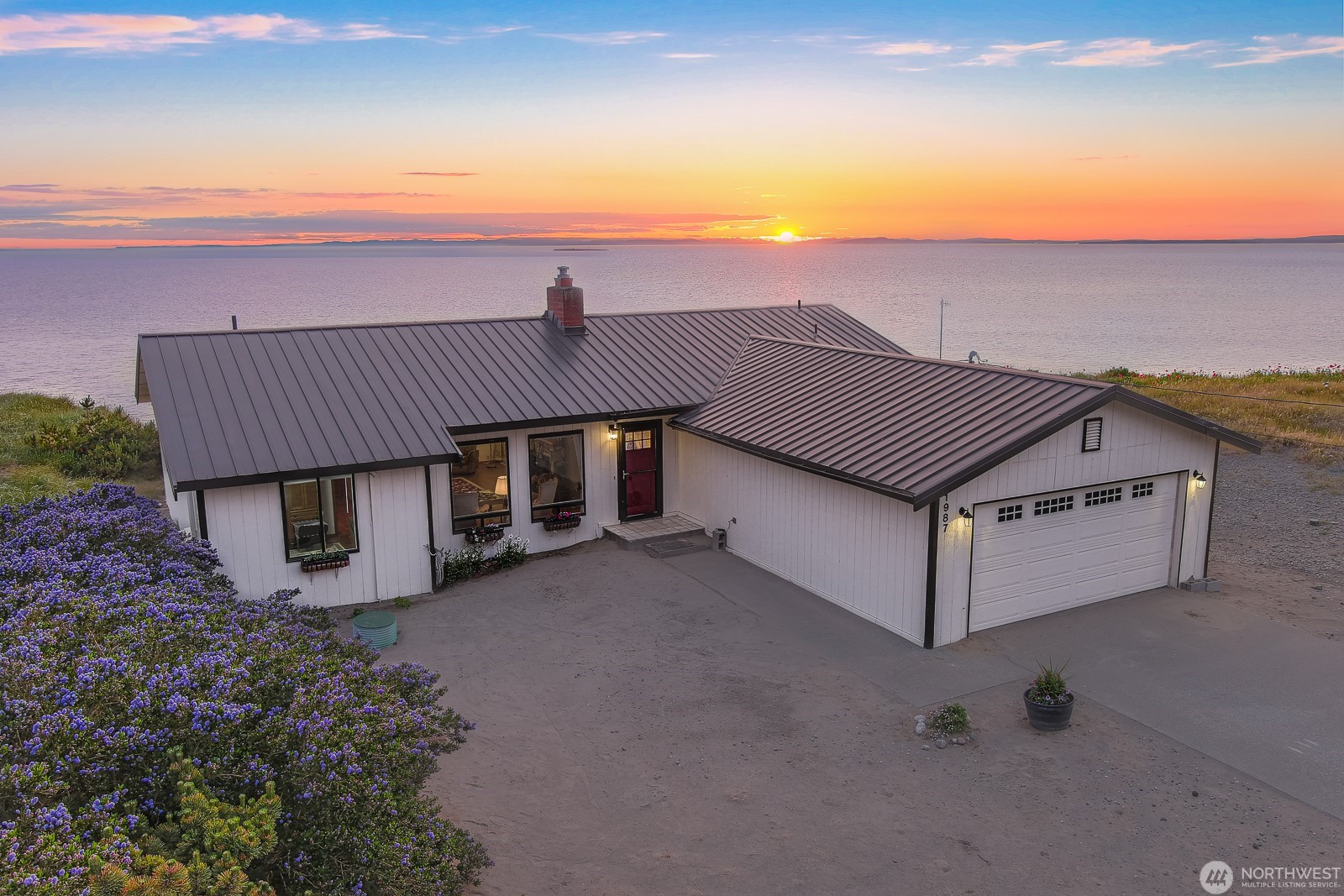
The tool is Google Earth Pro, desktop version. And the example that I'm going to use is this property right here.
This is on Whidbey Island, which is a beautiful island in the Olympic Rain Shadow, so it has very limited rainfall. It's looking straight out toward the water. This is a Vancouver Island and Victoria, British Columbia across the body of water here.
As you can see, this is a high bank property. So, if a buyer was looking at this and they said, hey Chris, what's the bluff stability look like on this shoreline? First, of course, would say, in order to get a really accurate determination, you should engage with a geotech consultant. But before you do, let's take a look at something. I'll pull up Google Earth Pro. I recommend the desktop version. I don't know if this particular functionality is available on the web version, but the desktop version works really well. So this is, would be Island right here. The property that we're discussing is right on this edge looking straight across that Victoria and out the Straight of Juan de Fuca to the Pacific Ocean.
So you can see it's got a really tall, looks like very sandy bluff here. The cool thing about Google Earth is you can zoom in and, with your, with your roller on your mouse. If you hold control while you use the roller, you can rotate it around to look at the shoreline. Then hold shift and use the roller and you can tip the camera up and down to look at the, look at the bluff.
So then if you come up to the top here and you click on this clock icon, it pulls up this timeline tool. What I like to do is go all the way back and you're going to get some grainy photos going all the way back to 1985 in this case but then what I'll do is I'll click on the mount on the time forward and so now we're at 2005 and more and more Google has been capturing satellite imagery so you're going to get better stuff.
What we're starting to see right here is a kind of a big cave forming under this property. What I'll point out is the property next door to what looks pretty solid right now and it's all undercut down here and very sandy but there's no big gouge out of the bluff on this neighboring property. So now we're going to keep going forward in time. A little bit grainy still 2007. You can see there's a big gouge right underneath the subject property. Still no gouges right here. There's still some sluffing down below at the toe of the bluff, which is, of course, a concern. Now, you could see now there's more sluffing down below. It's starting to get undercut. And you can see there was some more this neighboring property has now had a big slide down below. And, this is largely because of the wave action beating against the toe of the bluff. So now we're in 2015 and you could see there's a big hole forming on the neighbor's property next door. This one seems to have kind of stabilized to some extent, but, I think it's still fairly concerning. So now we're 2016. You can see there was another big slide down here that took off a lot of the stabilizing Bluff, that's 2017. And now we're 2018. Let's see, the neighbors property has got a even larger hole. 2020 and even larger hole next door is forming. 2022, they are starting to lose some of their land up top. And this is moving pretty quick now, considering it's only been a couple of years. And then that's the latest one, May of 2024. I'm gonna go back one year. What I would do is I would show a client this and gauge their comfort level with how fast the bluff is is eroding and the fact that the wave action at the toe of the bluff is causing systematic damage to the stability of it. And let them make a decision of if they want to engage a geotech at that point to actually do an evaluation and maybe come up with a mitigation plan.
This step could save your client thousands of dollars in doing this process. I learned this process from a geotech on a riverfront property that I own. He brought screenshots of all these historical aerial photos and said, this looks like bedrock on the surface. So, I'm not seeing any erosion here, so he should be okay.
Hopefully this is a tool that you can use to add value to your clients and demonstrate your shoreline expertise. And, particularly when it's a high bank property like this, but you can also use it for low bank properties to see effectively what sea level has done it. And, if you can people have bulkheads, and if their bulkheads have been sustained or added new bulkheads, any variety of things, this is a really helpful tool to look at the historical aerial imagery for the last 40 years.
I hope this is helpful. Please let me know if you have any cool tricks like this yourself. I'd love your feedback if this has been a valuable addition to your arsenal.
Posted by Chris Murphy on
Leave A Comment